Raystown Lake
Various Counties, PA
(2023)
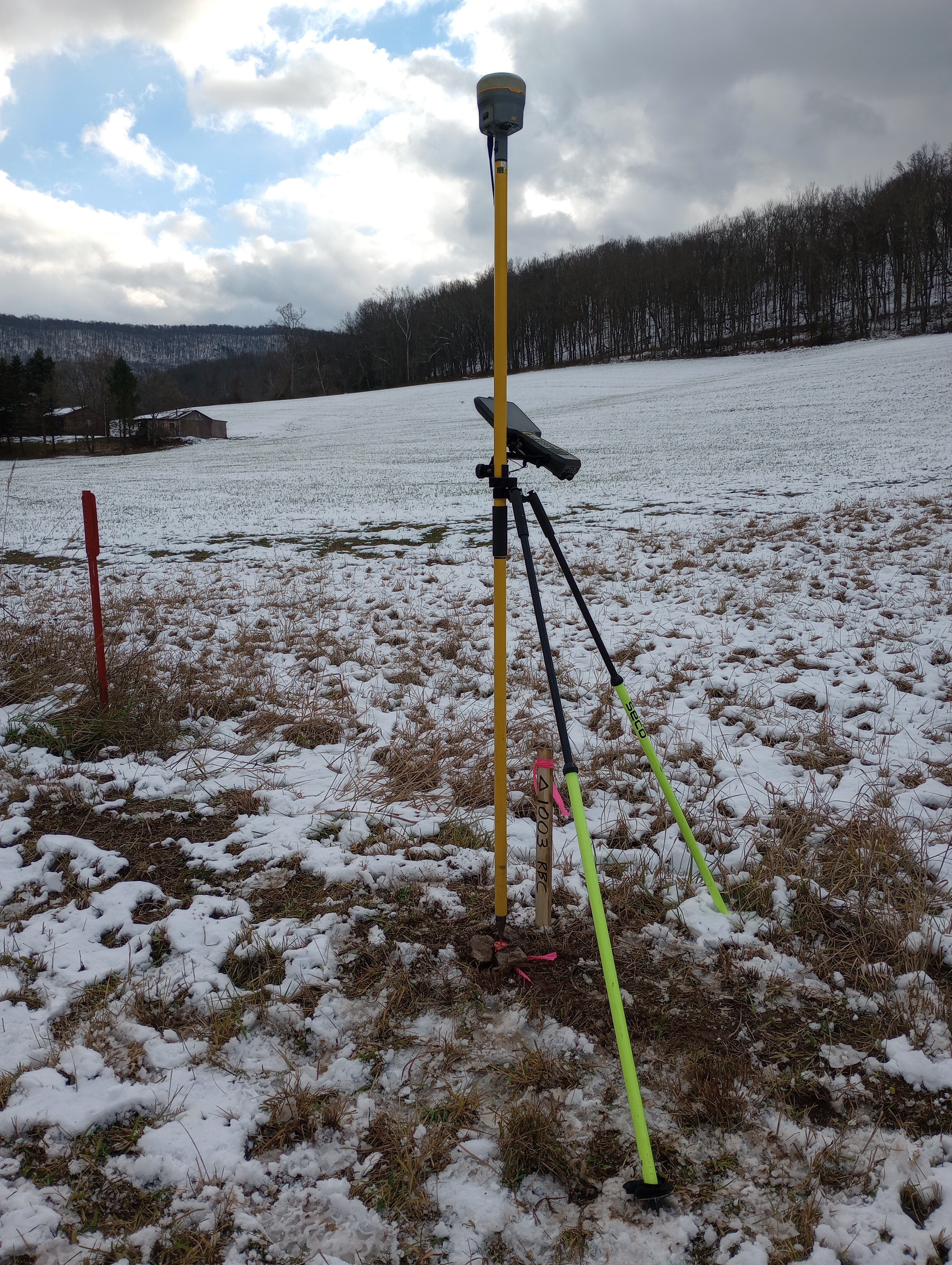
Honor Engineer Co. served as the prime surveyor for the U.S. Army Corps of Engineers, Baltimore District, at Raystown Lake, focusing on boundary rectification services for Government-owned land and flowage easement areas. The project involved locating, marking, or reestablishing survey monuments that identify USACE fee and flowage easement boundaries, which span 72 miles of fee boundary and 16 miles of flowage easement boundary. Over time, various survey pins were lost due to farming, excavation, erosion, and flooding, resulting in 143 missing fee boundary pins and 174 missing flowage easement boundary pins. Honor was tasked with locating and/or replacing 202 of these missing pins across six assigned CLINS. Our team used GPS/GNSS technologies and standard surveying procedures to recon, locate, mark, and reset the missing boundary pins. The project required navigating rugged terrain, irregular boundary geometry, and coordinating with both USACE Baltimore and private landowners.


